
Iceland
Northern lights in South Coast
16 viewing spots around South Coast, chosen for a dark sky and an open view. For each one: how dark it is, which way it looks, where to park and how to get there. Near the edge of the auroral oval: aurora on most active nights, low in the northern sky on quiet ones.
- Viewing spots
- 16
- Dark or very dark
- 16
- Magnetic latitude
- 63.4°
- Clearest dark month
- November 31 % of hours clear or partly clear
Which of these spots is clear tonight, and when? Aurora Atlas scores every spot hour by hour from the cloud forecast, darkness, the moon and live aurora activity, with live camera stills.
See tonight's live scores for South Coast in Aurora AtlasViewing spots
-
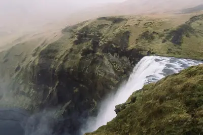 Skógafoss
The 60 m waterfall at Skógar on Route 1, with a large car park at its foot; the falls face south, so step back towards…
Skógafoss
The 60 m waterfall at Skógar on Route 1, with a large car park at its foot; the falls face south, so step back towards…
-
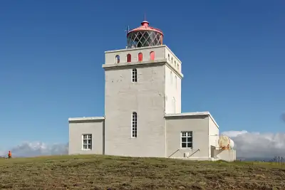 Dyrhólaey
A 120 m headland nature reserve west of Vík with a sea horizon on three sides and Mýrdalsjökull inland; the upper road…
Dyrhólaey
A 120 m headland nature reserve west of Vík with a sea horizon on three sides and Mýrdalsjökull inland; the upper road…
-
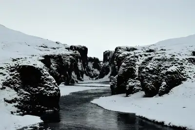 Fjaðrárgljúfur
Canyon about 100 m deep a few kilometres west of Kirkjubæjarklaustur, reached year-round by small car on Road 206…
Fjaðrárgljúfur
Canyon about 100 m deep a few kilometres west of Kirkjubæjarklaustur, reached year-round by small car on Road 206…
- Skaftafell (Vatnajökull National Park) The national-park visitor area below Skaftafellsjökull, open all year; the flat outwash plain in front of the centre…
-
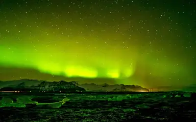 Jökulsárlón glacier lagoon
Iceberg lagoon beside Route 1 where calm water can mirror the aurora, with the ice-strewn beach across the road; one…
Jökulsárlón glacier lagoon
Iceberg lagoon beside Route 1 where calm water can mirror the aurora, with the ice-strewn beach across the road; one…
-
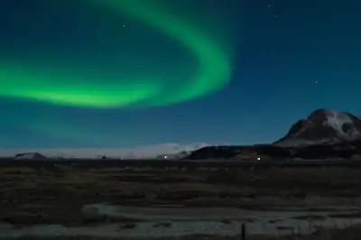 Seljalandsfoss
Waterfall off Route 1 near road 249; one of the most visited stops on the south coast, with paid parking.
Seljalandsfoss
Waterfall off Route 1 near road 249; one of the most visited stops on the south coast, with paid parking.
-
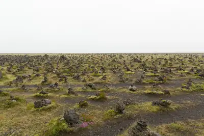 Laufskálavarða
Ring Road rest area where travellers build stone cairns, on the open plain between Vík and Kirkjubæjarklaustur.
Laufskálavarða
Ring Road rest area where travellers build stone cairns, on the open plain between Vík and Kirkjubæjarklaustur.
-
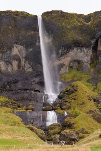 Foss á Síðu
Waterfall dropping off the cliff right beside Route 1, with a small viewpoint parking area; in a strong display the…
Foss á Síðu
Waterfall dropping off the cliff right beside Route 1, with a small viewpoint parking area; in a strong display the…
-
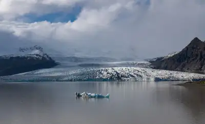 Fjallsárlón
Smaller glacier lagoon ~10 km west of Jökulsárlón, with a car park and a short walk to the shore.
Fjallsárlón
Smaller glacier lagoon ~10 km west of Jökulsárlón, with a car park and a short walk to the shore.
-
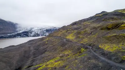 Sólheimajökull car park
Car park at the end of the short road 221 below the Sólheimajökull outlet glacier, ~10 km east of Skógar.
Sólheimajökull car park
Car park at the end of the short road 221 below the Sólheimajökull outlet glacier, ~10 km east of Skógar.
-
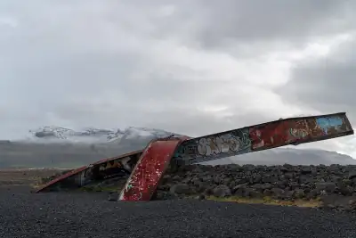 Gígjukvísl bridge memorial
Rest area by the twisted girders of the bridge destroyed in the 1996 glacial flood, on the open sandur west of…
Gígjukvísl bridge memorial
Rest area by the twisted girders of the bridge destroyed in the 1996 glacial flood, on the open sandur west of…
-
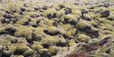 Eldhraun moss-lava stop · Route 1
Free gravel stop on Route 1 in the moss-covered Eldhraun lava field (1783 Laki eruption), with viewpoints next to it.
Eldhraun moss-lava stop · Route 1
Free gravel stop on Route 1 in the moss-covered Eldhraun lava field (1783 Laki eruption), with viewpoints next to it.
- Hjörleifshöfði north car park Paid car park (P1) on the north side of Hjörleifshöfði, the hill on the black-sand plain east of Vík with the "Yoda…
-
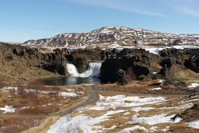 Hjálparfoss
Free car park (capacity 50) at the Hjálparfoss twin waterfall in the Þjórsárdalur valley, on the paved road towards…
Hjálparfoss
Free car park (capacity 50) at the Hjálparfoss twin waterfall in the Þjórsárdalur valley, on the paved road towards…
-
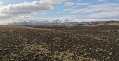 Sólheimasandur
Paid car park on Route 1 where the walk to the 1973 DC-3 plane wreck starts, on a wide glacial outwash plain with no…
Sólheimasandur
Paid car park on Route 1 where the walk to the 1973 DC-3 plane wreck starts, on a wide glacial outwash plain with no…
-
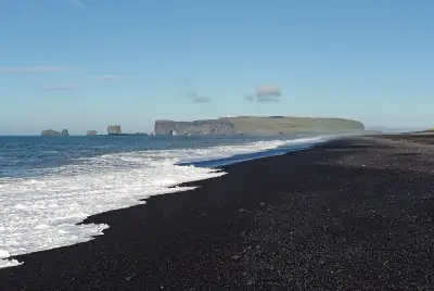 Reynisfjara
Black-sand beach west of Vík with basalt columns and the Reynisdrangar sea stacks. For the aurora, stay up at the car…
Reynisfjara
Black-sand beach west of Vík with basalt columns and the Reynisdrangar sea stacks. For the aurora, stay up at the car…
Drive times are estimates from the middle of South Coast by straight-line distance, as the app estimates them before it knows your route; ferries and winter closures are not counted.
All 16 spots, A to Z
Good to know in South Coast
- Pick the clear gap on the IMO cloud map The south coast is often cloudy from the sea while inland valleys clear. The Icelandic Met Office aurora page shows forecast cloud cover by hour; drive along Route 1 towards the gap rather than waiting under cloud. Source
- Keep away from the surf at night Sneaker waves on the south-coast beaches, Reynisfjara above all, run far up the sand without warning. In the dark you cannot see them coming: watch from the car park or a headland, never at the water’s edge. Source
- Stop only where it is safe on Route 1 Route 1 is the only road along the coast and has few lay-bys. Pull into a signed car park, never onto the shoulder or a single-lane bridge, and check umferdin.is for wind warnings before crossing the sandur plains. Source